written by Clea Harrelson ’20
RI-CHAMP is a digital dashboard that allows emergency managers to overlay hurricane and nor’easter prediction models onto data points across Rhode Island that mark critical infrastructure assets such as generators, transformers, roads, and pump facilities.
Emergency managers in Rhode Island and other coastal areas face mounting and interrelated environmental hazards such as flooding, hurricanes, storm surges, and sea level rise. To help decision-makers understand risks from these hazards and prevent or mitigate potential impacts, an interdisciplinary team of researchers from the University of Rhode Island (URI) and the Coastal Resources Center (CRC), in partnership with emergency managers across the state, has developed a new modeling tool to support strategic planning and response: Rhode Island Coastal Hazards, Analysis, Modeling & Prediction (RI-CHAMP).
Director, Providence Emergency Management Agency
“We’re all concerned about climate change and the impact of extreme weather, and now we’re developing the advanced tools needed to understand future impacts,” says URI Graduate School of Oceanography (GSO) Professor Isaac Ginis.
He co-leads the RI-CHAMP team alongside URI Associate Professor Austin Becker, marine affairs, and CRC Pam Rubinoff, associate coastal manager and coastal resilience and extension specialist.
The central product of RI-CHAMP is a digital dashboard that allows emergency managers to overlay hurricane and nor’easter prediction models onto data points across Rhode Island that mark critical infrastructure assets such as generators, transformers, roads, and pump facilities. Three- hundred and sixty data points have been created so far by surveying Rhode Island emergency and facility managers.
By collecting information about equipment or site features that are key to the operation of a facility in one central tool, managers and researchers can better understand the potential cascading impacts of storms, such as the inability to access a transformer due to flooding.
Professor, Graduate School of Oceanography
The novelty of this project has earned the RI-CHAMP team $2.6 million from the Department of Homeland Security (DHS) Science and Technology Directorate’s Coastal Resilience Center of Excellence program since 2016. In addition, RI-CHAMP has received multiple awards from the National Park Service, the National Oceanic and Atmospheric Administration (NOAA), the U.S. Department of Defense Office of Local Defense Community Cooperation, and Rhode Island Sea Grant, for related projects since its inception.
Becker describes the cutting-edge combination of storm and local infrastructure data as only the beginning for both risk analysis (using past storms or simulated storm models) and real-time prediction of impacts from active storms.
“This basic setup is customizable, so it could really be used with any facility complex, or piece of infrastructure,” Becker says.
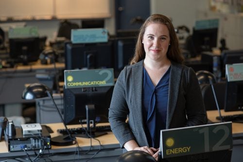
Clara Decerbo ’18 director of the Providence Emergency Management Agency (PEMA) and one of the managers involved in RI-CHAMP, is already putting components of the tool to work at PEMA.
“We do trainings and exercises for the Providence mayor and his senior staff every year, and in 2021 we were able to plug different variables into the RI-CHAMP dashboard and use those outputs for exercise scenario modeling,” Decerbo says. “Having a visual of what a potential storm’s impact can look like in our city is really helpful.”
Associate Professor, Marine Affairs
One way RI-CHAMP models have impacted decision- making in Providence is through analysis of the Fox Point Hurricane Barrier, built across the Providence River in the 1960s to protect the downtown area against storm surges.
“The hurricane barrier has never been tested in big storms, so we were able to do a simulation of what would happen if the barrier was closed and if the barrier was open,” Ginis says.
In one scenario called “Hurricane Ram,” Ginis and his team created a hypothetical storm that stalls over Providence for one day, resulting in heavy, sustained rainfall. The modeling produced for “Hurricane Ram” highlight areas of vulnerability and are an important tool for emergency managers and planners working to mitigate flooding risk in high- risk communities and proactively prepare for future storm events.
Given that many major coastal cities in the U.S. such as Boston or New York face compounding challenges of extreme weather events and climate change impacts such as sea-level-rise, both Becker and Ginis highlight that RI-CHAMP serves a model for emergency managers and researchers in other areas.
“It is absolutely a scalable concept,” says Becker. “So long as there are storm models that can be run at a high enough resolution to be useful at the local scale, there’s no reason this can’t be done in other areas to help emergency managers and planners understand potential consequences.”
“This basic setup is customizable, so it could really be used with any facility complex, or piece of infrastructure.”
–Austin Becker
Becker and Ginis emphasize that the resolution of data, for both storms and facilities, is what makes this project stand out.
High-resolution oceanic and atmospheric data and modeling provide critical detail and accuracy for the wind, wave, and storm surge variables that make up RI-CHAMP’s hurricane and nor’easter scenarios. Ginis argues that high-resolution data and modeling allow managers to be proactive in planning for impacts on specific assets, like generators, in a way that is “unprecedented.”
“We are very site-specific to accurately simulate whether a facility may fail under certain conditions, such as storm surge flooding,” Ginis explains. “We are actually able to put the elevation of a generator at a specific facility into our computer model.”
RI-CHAMP team members worked with infrastructure facility managers to create baseline thresholds for a facility. Common vulnerabilities considered include access to a site (in the event that roads are flooded), function of key equipment such as generators, and impacts to potential evacuation routes. Facility data was primarily collected by student researchers through site visits and conversations with managers across the state.
“Typically, the weather prediction models from the National Weather Service have spatial resolution on the order of 10 kilometers, and the best hurricane models on the order of 1 kilometer,” he adds. “We’re working in RI- CHAMP at a much higher resolution of 10 meters.”
RI-CHAMP’s innovative modeling is informed by Ginis’ distinguished, 28-year career in this field, which includes the development of forecasting models actively used by the NOAA National Hurricane Center and Joint Typhoon Warming Center. After working on the fundamental science of extreme weather models, Ginis says he now prioritizes research that he thinks people will actually use and that this is what drew him to the RI-CHAMP project.
“That’s why this tool is so powerful,” explains Becker, “Instead of applying Ginis’ models to generic maps, we’re letting managers tell us what’s important to them at a local level and helping them figure out how to adjust based on different scenarios.”
According to Becker and his team, building strong relationships with state agencies, facility managers, and emergency mangers has been essential in understanding the social impact of extreme weather events.
Becker describes the CRC as playing a key role in brokering relationships with managers across Rhode Island.
“Practitioners were brought in from the very beginning,” says Becker. “We went to RIEMA with our concept for RI- CHAMP and said, ‘Would this be useful to you?’”
Decerbo underscores the importance of engagement.
“Frequently with these types of tools are built in a silo in academia and then just spit out to the field,” says Decerbo. “RI-CHAMP has done a really good job of including people from the practitioner realm, which makes the tool much more user-friendly and valuable.”
In addition to frequent communication with emergency managers through data collection, trainings, and meetings with an informal steering committee of practitioners, Becker and Ginis credit teamwork among URI researchers and students for their success.
RI-CHAMP STUDENTS
Supporting the professional development of students is a central goal of the RI-CHAMP project. Students have taken on leadership roles at every stage of the project.
Becker highlights, “It’s been such a great opportunity for students to not only gain research skills and see the challenges of applied research but also to just network and get to know people in this field.”
“I think there’s a huge amount of mutual respect for the different pieces that each discipline contributes, including the outreach by CRC.” Becker says. “Having an interdisciplinary team has been incredibly important for us.”
A full prototype of the dashboard was shared with the RI-CHAMP steering committee for preliminary review in January 2022. The RI-CHAMP team hopes to transition management of the dashboard to RIEMA over the next year so that data is in the hands of decision-makers and to ensure that assets can be easily updated as necessary.
The RI-CHAMP team is also in the process of exploring ways to adapt the dashboard for real-time prediction in the 2022 hurricane season, which would allow facility managers with sites in the path of active storms to receive electronic notifications about the potential threat to infrastructure.
Deb Crowley
Ph.D. candidate, Graduate School of Oceanography
For Deb Crowley, a second year Ph.D. student in URI’s Graduate School of Oceanography (GSO), high-quality data and robust models are the
first line of defense against coastal hazards like hurricanes and nor’easters.
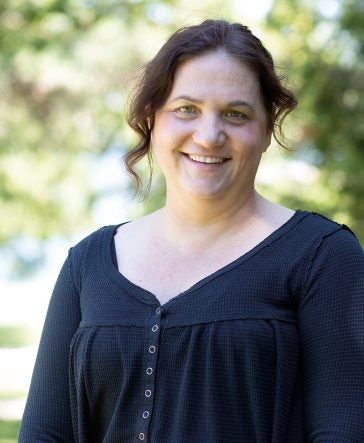
Ph.D. candidate, Graduate School of Oceanography (GSO)
“The more we understand about storm conditions and impacts, the better we can plan,” Crowley says. “When it comes to storm modeling, you’d always like more data.”
She notes that even seemingly simple goals, like validating flooding during and after a storm, can require getting creative, including scouring the internet for photos and videos of impacted areas.
But these challenges are worth it, as Crowley argued that the suite of storm models she has helped develop for the RI-CHAMP project matter not just for those interested in assessing potential damage to buildings and infrastructure but to everyone who lives in a coastal area.
“Even if you’re not directly hit, there’s a chain reaction of impacts,” she says. “Understanding the timing of a storm, how to best prepare – it’s all important. Some of the work feeds into evaluating evacuation routes. There are things that you need modeling to evaluate.”
“The more we understand about storm conditions and impacts, the better we can plan. When it comes to storm modeling, you’d always like more data.”
–Deb Crowley
Crowley attributes the success of the RI-CHAMP team to good communication and says that being able to work with faculty and students across GSO, Marine Affairs, and CRC has been an important benefit of participation in this project.
In addition to the RI-CHAMP dashboard project, Crowley is involved in multiple other storm modeling initiatives with URI Professor Isaac Ginis, including a partnership with the National Park Service to study nor’easters and a NOAA project focused on resiliency planning.
One common thread throughout her work is a strong focus on getting data into the hands of decision-makers.
“For me, I really want what I’m doing to be useful for someone, and so it’s really meaningful to see these models being put to use for such a great purpose to prepare and protect communities,” says Crowley.
Kyle McElroy
Ph.D. candidate, Marine Affairs
Ph.D. candidate, Marine Affairs
Although the novelty of uniting coastal hazards data and critical infrastructure data through the RI-CHAMP dashboard is exciting, Kyle McElroy can’t wait until this tool and the protocols the RI-CHAMP team has developed are standard practice.
“That’s what I’d view as success,” she says, “all of the data we’ve collected and materials we made being used regularly by emergency managers.”
McElroy, a second year Ph.D. student in URI’s Marine Affairs Department, joined the RI-CHAMP project just as the team was expanding data collection on critical infrastructure facilities for wastewater and maritime treatment facilities statewide. After quickly coming up to speed, she created a data collection tool using the online digital map, ArcGIS Survey123, and dove into working with facility managers to enter data about vulnerable infrastructure.
“The ultimate goal is to have facility managers be able to use this tool themselves,” McElroy explains. “Managers will review and update their data annually, so if a facility or particular asset changes, that would be reflected in the dashboard and models.”
In addition to data collection, McElroy has also led efforts to develop training materials and videos to aid in the transition of dashboard operations from the RI-CHAMP team to RIEMA and she helps run the steering committee that supports the RI- CHAMP project.
“The ultimate goal is to have facility managers be able to use this tool themselves.”
–Kyle McElroy
Maintaining close contact with the steering committee and the development of training materials are nearly as important as the tool itself.
“Longevity of the tool is a priority for everyone,” she says.
Data collection and close collaboration with emergency managers has also provided unique opportunities to connect with practitioners.
“I am someone who always believes in networks,” says McElroy. “I worked with the U.S. Army Corps of Engineers as a coastal engineer before coming to URI. So, working with emergency management and increasing my network and knowledge when it comes to coastal hazards and impacts has been valuable to me. I’m also interested in long- term coastal resiliency planning and seeing this side of response is huge.”
Sam Adams
Ph.D. candidate, Marine Affairs, Director, URI Emergency Management and Assistant Director, Public Safety
“The traditional processes and indicators used to assess damage from coastal hazards like storms are a little strange to me,” says Sam Adams. “It’s all focused on the economic cost of replacing buildings or the percentage of infrastructure destroyed rather than the actual impact to the community.”
Ph.D. candidate, Marine Affairs, Director, URI Emergency Management and Assistant Director, Public Safety
He hopes to shift this perspective to include the more nuanced and often cascading impacts of hurricanes and nor’easters through his role as URI’s emergency management director and assistant director of Public Safety and through his Ph.D. studies in marine affairs as part of the RI-CHAMP team. For his dissertation Adams will focus on how tools like the RI-CHAMP dashboard are implemented by emergency management agencies.
Adams’s interest in the vulnerability of coastal communities is also personal.
“I grew up in New Orleans and was affected by Katrina,” he shares. “That’s what got me interested in emergency management in the first place.”
His personal ties to coastal communities and professional experiences working as an emergency manager for the past 15 years are what motivate him to focus on building a system that’s useful.
“I’ve been a translator for our team,” explains Adams, of his multi-faceted role in RI-CHAMP.
“I help define what’s useful for an emergency manager and lead trainings about how to use the dashboard.”
Adams is also excited to use his dual role as a student and an emergency manager to think critically about how hazards are identified and the impact of climate changes on hazard response for URI. Working with a consultant and other internal URI partners, Adams’s emergency management team is in the process of developing a new hazard mitigation plan for the University.
Adams is also excited to use his dual role as a student and an emergency manager to think critically about how hazards are identified and the impact of climate changes on hazard response for URI.
“We are going to collect data on critical infrastructure on the Narragansett Bay Campus, which we’re then going to model in RI-CHAMP,” he says. “This will be the first time we have the opportunity to use the outputs from RI-CHAMP and incorporate them into an actual hazard mitigation plan. It’s very exciting.”
Effectively implementing RI-CHAMP through projects like this is important to Adams to provide immediate benefits but also to advance broader conversations in his field.
“I’ve reached the point in my career where I want to be more than just a good emergency manager,” Adams says. “I want to contribute to the foundation of my profession. This is how I can start to make change.”