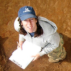
From the ground, anyone who’s driven through New England has seen the seemingly randomly placed stone walls running here and there under the forest canopy, and have speculated about what they may have denoted long ago. Geographer Katharine Johnson ‘06 may have the answers. Using high-tech scanners called light detection and ranging (LiDAR), she’s been able to locate abandoned homesteads, hundred-acre farms, stone walls, and other barely perceptible remnants of a largely agrarian New England.
“The landscape is very dynamic, and we are seeing cultural features that span hundreds of years of New England history,” Johnson said. “Many of the abandoned farmsteads we are finding date from the 18th through the early 20th centuries. There may be older ones as well – we will need to verify this with archival research.”
Johnson, who’s now a Ph.D student at University of Connecticut, and her advisor, William Ouimet, published these findings in a paper in the Journal of Archaeological Science. The discoveries explained in the paper have been reported in National Geographic, Science magazine, NPR, and the Huffington Post.
With LiDAR, the airborne technology bounces laser light pulses off the ground to generate precise pictures of surface features. “We can survey large areas at one time using LiDAR, and this allows us to gain a comprehensive understanding of the landscape’s history,” Johnson said.
In Tiverton, R.I., for instance, Johnson’s work revealed a dam and the walls of a once-buzzing sawmill. In Ashford, Conn., a vast network of roads and stone walls peaked from beneath the canopy of the forest that’s been growing there since the late 1800s. And in Westport, Mass., a comparison of historic maps from the 1700s against modern property boundaries overlaid with the weathered stone walls uncovered by LiDAR, reveals that certain property demarcations have barely changed in more than 300 years.
Johnson says these discoveries can help quantify the impact that English-style agriculture had on the continuity between historic and modern landscapes. They could also create a living history of the ecosystem over the centuries and help historical societies document new landmarks.