Veronica Berounsky is a longtime open-water and cold-water swimmer, often jumping in at the Narragansett Bay Campus beach for an ocean swim, no matter the season. She shares her first experience of swimming from the headwaters to the mouth of Narrow River, watching the marine life change as she goes. Having now done this source-to-sea swim three times, she says swimming slowly enough to observe and experience the river is key.
By Veronica M. Berounsky, Ph.D. ’90
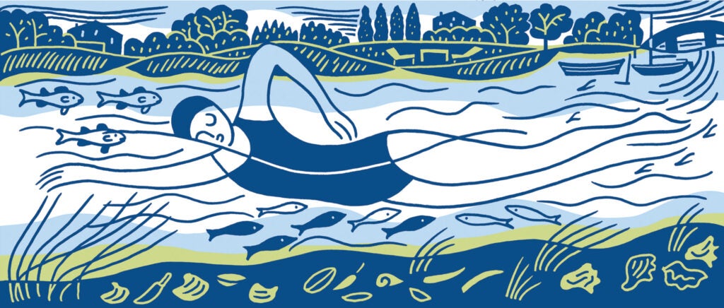
It’s dark when my alarm rings, but I’m immediately awake. Today, I will swim the length of Narrow River—all 6 miles of it, from North Kingstown to Narragansett, R.I. I’ll be joined by two swimmer friends, Lori Pugh and Keith Ballard.
My safety kayaker, Jerry Prezioso, M.S. ’91, launches into Gilbert Stuart Stream in the dim light, and my swim starts. The stream looks much like it did when Stuart, the renowned American portraitist best known for his unfinished painting of George Washington, was born in 1775 in the house at the stream’s dam. I imagine him walking the road beside me as I swim.
The stream flows into Upper Pond. As I cross the 1-mile distance of the pond, which feels wide open after swimming the narrow, tree-lined stream, I glance to the east and see the sun rising over the trees. It takes my breath away.
I’ve been on Upper Pond hundreds of times to collect water samples for URI and Narrow River Preservation Association, but it’s different to be in the water. Too small to be seen by eye, I know there are single-cell plants (phytoplankton) floating in the water with me, using the sunlight for energy to grow. There are single-cell animals (zooplankton) here, too, eating those plants. Near the middle of the pond, there are 13 meters of water below me. That’s deep enough to hide most of Point Judith Lighthouse.
I also know that the water from about 4 meters deep to the bottom is naturally without oxygen; the bacteria there get their energy from naturally occurring odiferous sulfur. But here, at the surface, there is no evidence of that.
As I approach the southern end of Upper Pond, the bottom rises to about 1 meter deep, forming Casey Sill. I float over it into Lower Pond.
Along the edges of both ponds, I see oysters, Crassostrea virginica. Even here, 5 miles from the ocean, seawater comes in with the tide and mixes with the freshwater, creating an estuary—Pettaquamscutt Estuary. The salinity here is ideal oyster habitat.
At the shallow southern end of Lower Pond, I’ve been swimming for 2 miles; I glide over the bottom, paved with oysters. The outgoing tide whisks me under Bridgetown Road Bridge.
At Mettatuxet Beach, the halfway mark, I see soft-shell clams, Mya arenaria. They thrive in saltier water than oysters do.
Just before Middlebridge, I spy razor clams, Ensis leei. I’ve been swimming for 4 miles. Passing beneath the bridge, I see eelgrass, Zostera marina, which does well where sunlight can reach the bottom. Blue mussels, Mytilus edulis, appear—evidence of saltier water.
At the 5-mile mark, swimming under the third and final bridge, Sprague Bridge, I also see quahogs, Mercenaria mercenaria.
As I make the final turn to flow out with Narrow River to Rhode Island Sound, I see surf clams, Spisula solidissima, under the waves. I turn to Jerry and say, “We made it!” Lori, Keith, and I lock hands in the waves, celebrating our swim.
Veronica M. Berounsky, Ph.D. ’90, is a coastal ecologist and is the alumni relations and communications coordinator for the Graduate School of Oceanography. She also serves as co-president of the Narrow River Preservation Association and chair of the Rhode Island Rivers Council.
Illustration: Anthony Russo
Fun to read, Thanks ! Congrats to Anthony Russo for the cool illustration. It’s great !
My favorite place on Earth